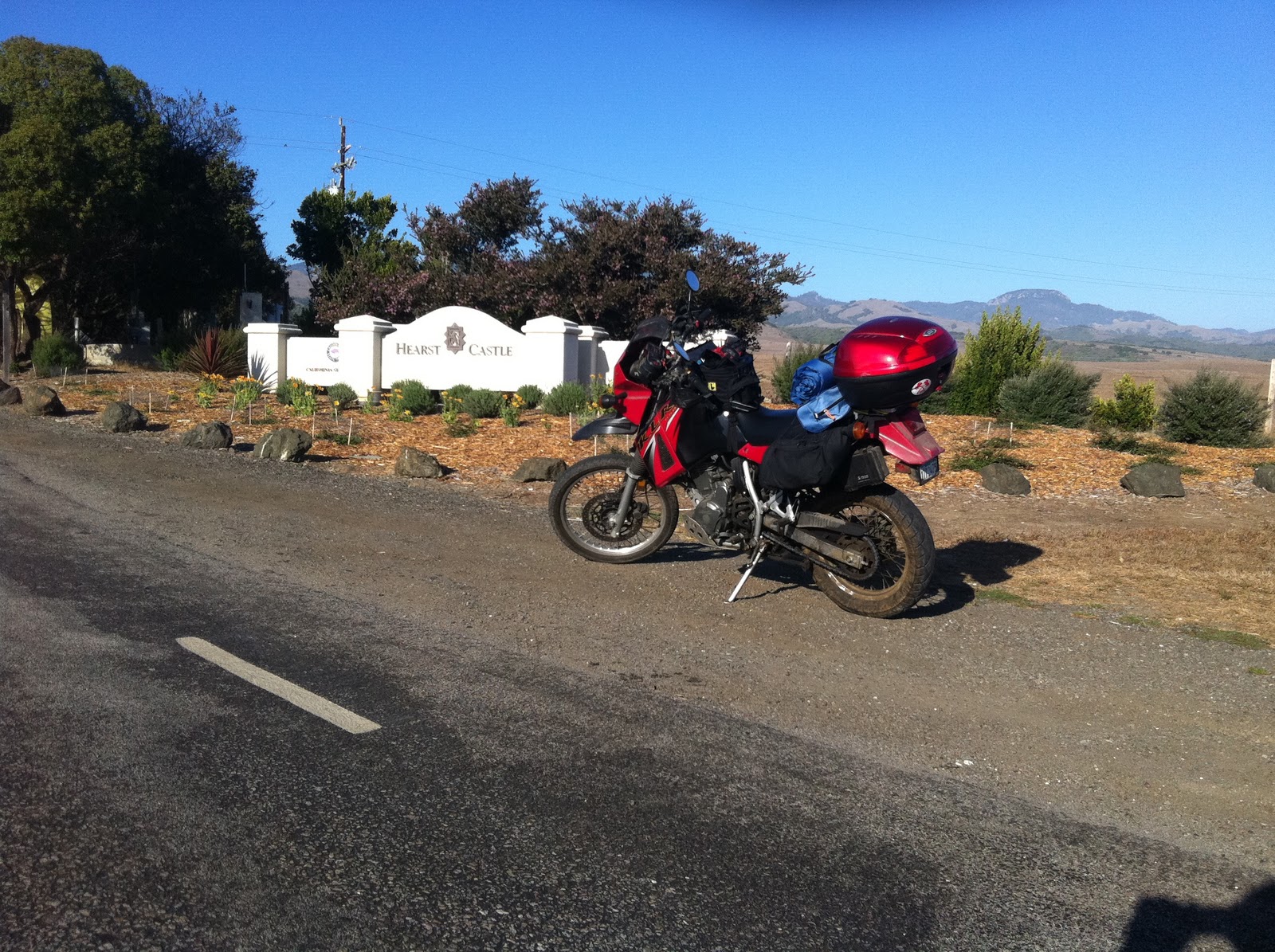
Day 2: Monterey to Mendocino
There be (almost) no freeway here, the coastline is everywhere
Day two started in typical “I just stayed at an overpriced motel” fashion with a breakfast that consisted of some cereal, yogurt, a hard-boiled egg, and mediocre coffee (little did I know that this would be gourmet compared to the next two days). Nothing to write a “Dear Mother” letter about, but adequate to get going. Face stuffed, the luggage went back on the bike and it was time to get going. Northern California wasn’t going to get closer on its own. It was here that I found out that my can of chain lube was empty. I coaxed enough out to coat the KLR’s chain, but after that it ran dry. Oh well, a new chain was going to be fitted before the next long ride anyway.

The Monterey to Santa Cruz stretch of highway 1 is mostly uneventful slab. Twice I considered detouring inland to bypass San Francisco, the first resulting in a slight detour though Castroville, the self-proclaimed “Artichoke Center of the World” and one of many Central California agricultural towns that clearly had seen better days. There was one auto shop there that had a beautifully painted dark red hot rod of some sort, definitely of late 40s/early 50s vintage. In hindsight, I should have grabbed a picture.
Past Castroville, I came across three giant motorcycle sculptures made out of different forms of metal and tractor tires in front of a joint called Eagle Iron and Leather. Adjacent to it was a milsurp store, the proprietor of which opted for the unusual-for-coastal-California flying of the Confederate Battle Flag. I chose not to get too curious and went on my merry way.

Not too far further down the road, I thought it’d be a brilliant idea to hang a left onto a road between some fields to go look for a state beach. Might have been Zmudowski. That’s irrelevant, since I didn’t get to it, choosing instead to pull over to throw on my cold-weather gloves, scarf and balaclava since it wasn’t getting any warmer. On the way back to the highway, I came across the rather odd sight of an old CRT TV lying on the side of the road. There’s a tragic metaphor for the current state of America in here somewhere. It was also here where I discovered that the iPhone’s screen doesn’t like to respond to thick gloves, which would prove to be a minor pain in the ass for the next day and a half or so.

Shortly thereafter, the 1 once again turned into a freeway. An attempt to bypass it after a fuel stop in Aptos lead to a swing past Cabrillo College, at which point the decision was made to get back on the freeway and get past Santa Cruz, a city that based on my observations while riding through is filled with bicycle shops and poorly-dressed young adults. Before the road got fully coastal again was the town of Davenport, which is highlighted by the quaint yet welcoming-looking St. Vincent de Paul Chuch. Past Davenport, scenic turnouts onto a state beach of one form or another become commonplace. In fact, the lack of development on the coast – and the huge amount of untouched nature -- between Santa Cruz and San Francisco was rather surprising to this Angeleno, seeing as how we’ve turned out coastline into stripmalls and mansions.

Lunchtime arrived at about the same time that I arrived in Half Moon Bay. I grabbed a bowl of delicious clam chowder and a cup of solid coffee at some restaurant that doesn’t seem to be on the internet right by the marina (and I can’t look it up on any credit card statements since I paid cash). This is how you’re supposed to eat on these trips. Unfortunately, I ended up doing it wrong the rest of the way. Past Half Moon Bay, Moss Beach, and Montara is a considerable tunnel project – two mile-long tunnels, one for northbound and one for southbound traffic, are being built to bypass a bit of road that’s plagued by rock slides. Come early next year, the road to San Francisco will be a little bit straighter.
Speaking of San Francisco, I continue to be amazed at how un-American it is in terms of motorcycle usage and accommodation. 19th Avenue, which serves as the route of the 1 through the city, was filled with bikes, and not just the parked variety in front of SFSU. I reckon traffic in LA would be a good deal lighter if the rate of motorcycle commuting was as high as it is in SF. Unfortunately, LA isn’t nearly as accommodating to alternative forms of commuting. At least not yet.

Leaving SF going north necessitated a trip down the Gold Gate Bridge. Fortunately, it’s toll-free heading out of the city and I turned off at the outlook that’s just past the bridge (heading up to the park to the west of the bridge would have taken too much time). Central to outlook is the memorial to the Lone Sailor, which also features a plaque dedicated to the three seafaring branches of the US armed forces as well as the merchant marine (the USMC got the freakiest-looking one). This Lone Biker felt some semblance of kinship with the lone sailor…and then got back on the bike and headed up to the Muir Beach Lookout. The Golden Gate out stop was to be the last bit of familiar ground for several hundred miles.
 |
| View from the Muir Beach Lookout |
Like so many other spots on the coast near San Francisco, the Muir Beach Lookout was a naval defense position during WW2. Now, it’s just a place for tourists to take bad pictures and the contemplative to do some contemplating if they so choose. The road gets nice and twisty long before the Lookout and stays this way, to varying degrees, for almost the entire duration of my trip on it. In normal circumstances, this would be splendiferous. But this isn’t normal – I’m cold, on a laden-down KLR with tires of questionable quality on a road I’ve never been on before. Speeds plummet, though fun is still had. I briefly chase a guy on a KTM Duke of some sort and do a decent job of keeping up without trying too hard. The XR would have eaten his lunch.
 |
| Approaching Bolinas Bay |
Past the Muir Beach Overlook is Bolinas Bay and the Bolinas Lagoon, which is quite massive, but it would not be most unusual water feature I’d come across. That title goes to Tomales Bay, which is about 18 miles further up the road and runs for about 10 miles. From the road, it looks like a giant lake and only thanks to the countless Oyster shops in tiny fishing villages like Millerton and Marconi do you get the idea that this is actually a piece of the ocean. Thanks to the hills on the west side of the bay, the marine layer stayed away, providing a respite from the cold air and overcast skies. At the Hamlet of Hamlet, the road heads inland for about 18 miles, reaching the coast again at Bodega Bay.
 |
| Tomales Bay |
About the only place I specifically wanted to visit was Fort Ross, which is about 23 miles up the road from Bodega Bay. It was a Russian settlement during the first half of the 19th century and is now a state park, with many of the buildings having been reconstructed, including the Orthodox Chapel. Alas, by the time I got there, the park was already closed. There’s always next year.
The remaining 75 miles of the day’s ride was uneventful. The weather would stay clear and cool the entire time, the road would alternate between being relatively straight and super-twisty, and there were numerous small towns like Point Arena and Albion to pass through. I got a little squirly about gas, I had plenty left when I finally filled up in Mendocino. During the fuel stop, I also looked up the nearest campground, which happened to be about 4.5 miles up the road in a no-horse town called Caspar.

It was towards the end of this day that I also made the decision to cut down the length of the ride as the inadequacy of the KLR’s seat was beginning to make itself acutely clear. Dinner was campfire-grilled hot dogs on a knife and some raisins that I picked up back in Mendocino after dropping off most of my stuff at the campsite. As I found out, a roll of firewood fits nicely into the Givi case. Due to a lapse of reason, a Satan-worshipping woodland critter (likely a raccoon) made off with a bag of trail mix and a Clif bar. The persistent bugger proceed to make lots of noise for quite some time in his vain attempts to get past the bar’s packaging.
 |
| Somewhere south of San Francisco |
 |
| San Francisco |
 |
| The Lone Sailor monument |
 |
| Bolinas Lagoon |
 |
| First turnout after making it back inland |
 |
| Things cleared up closer to Mendocino |
 |
| Campfire! |

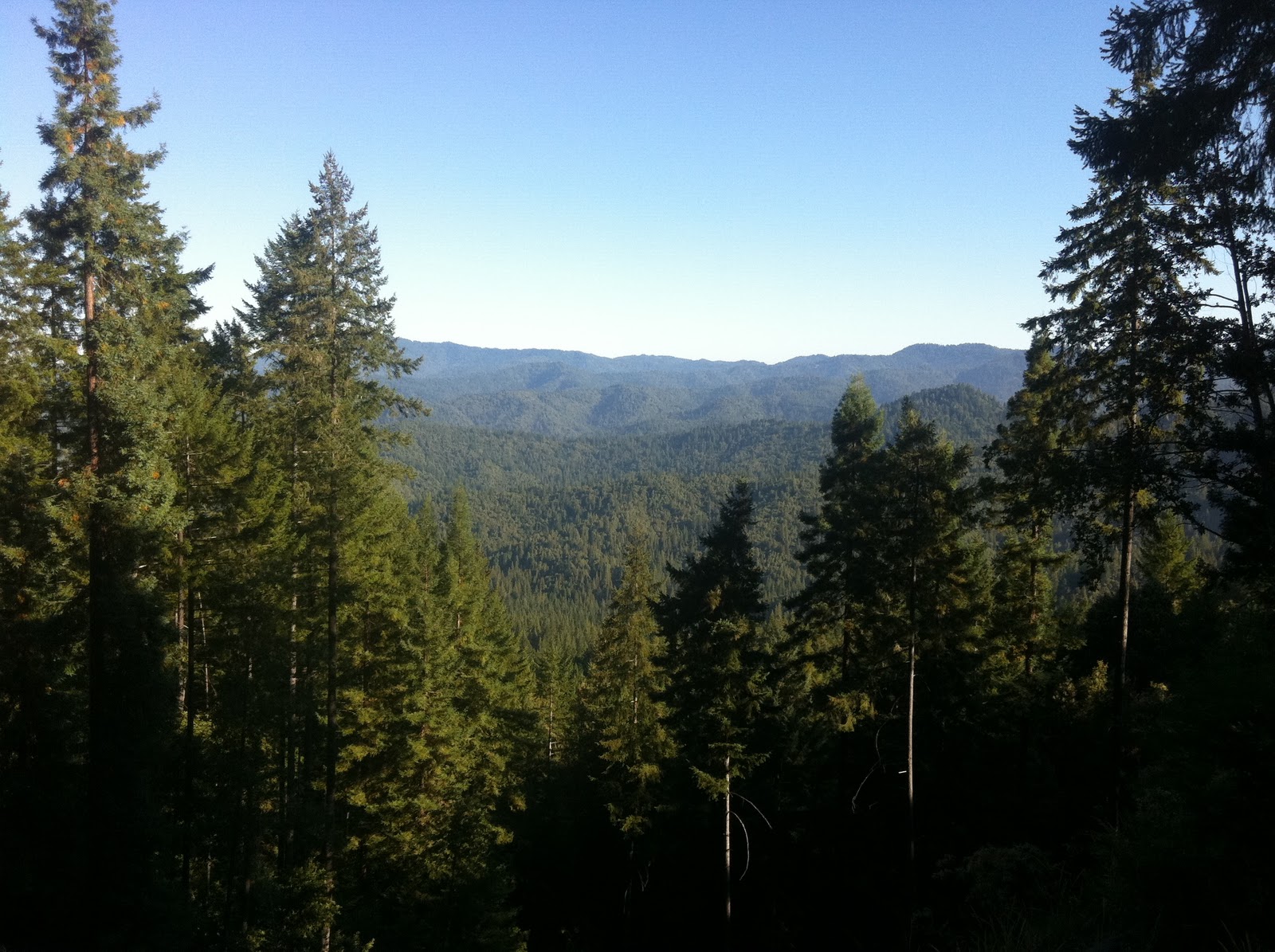 The Northern California coast doesn’t provide too many opportunities to head inland. Mountains tend to get in the way like that. Fortunately, there’s an east-west highway – state route 20, also known as Fort Bragg-Willits Road -- just to the south of Fort Bragg. Conveniently, Fort Bragg was just a few miles north of Mendocino. As it turns out, the 1 to 101 stretch of the 20 happens to be absolutely spectacular, if somewhat cold. Most of it through Jackson State Forest and the remainder might as well (though I did see a logging camp towards the end). If you like your great drives filled with evergreen trees as far as the eye can see, this is roughly 35 mile long stretch of road is right up your alley. It hits the 101 in the town of Willits and then heads back east a few miles to the south, past Lake Mendocino and towards Clear Lake.
 Along the way lie several European-named towns, including Nice (it’s not as nice as the one in France) and Lucerne (the self-proclaimed Switzerland of America; curiously, I didn’t see any banks, watch stores, or speed cameras. I did, however, see a marijuana dispensary. After all, this is California).
 I should point out that the further east I went, the hotter it got. The jacket liner came off at Lake Mendocino and I was really glad that I could keep moving as I passed Clear Lake. Unfortunately, construction forced a 5-10 minute time out on the road, during which the heat made itself readily apparent and I began wishing that I’d packed a perforated jacket. I didn’t because the original plan called for going around the Central Valley, rather than across it. Oops. Things began to get proper toasty as I began to approach the town of Williams, at which point I became really thankful for my Platypus bag and the water it contained.

 In Oakhurst, the 41 dead ends into the 49 and it was here that I made the decision to tough it out to Fresno, partly in order to get up early and miss most of the heat on the way back to the coast. Initially, I headed for a Holiday Inn Express, but they wanted something like $110. Then, my brained turned on and I used the power of the internet to find a local Motel 6. $45 secured me crappy room in a sketchy-looking part of town, but hey, you get what you pay for and who is going to steal a KLR anyway. Besides, all I really wanted at that point was somewhere to lie down for a few hours. I finished the day with yet another trip to Carl’s Jr. (the first was for lunch in Yuba City due to a lack of anything better) and a couple warm PBRs. Ain’t life grand.