
Day 3: Mendocino to Fresno
Fuck it, Going East
 The Northern California coast doesn’t provide too many opportunities to head inland. Mountains tend to get in the way like that. Fortunately, there’s an east-west highway – state route 20, also known as Fort Bragg-Willits Road -- just to the south of Fort Bragg. Conveniently, Fort Bragg was just a few miles north of Mendocino. As it turns out, the 1 to 101 stretch of the 20 happens to be absolutely spectacular, if somewhat cold. Most of it through Jackson State Forest and the remainder might as well (though I did see a logging camp towards the end). If you like your great drives filled with evergreen trees as far as the eye can see, this is roughly 35 mile long stretch of road is right up your alley. It hits the 101 in the town of Willits and then heads back east a few miles to the south, past Lake Mendocino and towards Clear Lake.
 Along the way lie several European-named towns, including Nice (it’s not as nice as the one in France) and Lucerne (the self-proclaimed Switzerland of America; curiously, I didn’t see any banks, watch stores, or speed cameras. I did, however, see a marijuana dispensary. After all, this is California).
It was on the 20 that California Historic Landmark signs became more common. One of the more notable ones was Number 427, which marked the site of a place called Bloody Island. It got that name thanks to a rather royal dick move on the part of the US Army back in 1850, during which a dragoon regiment slaughtered basically all of the Native residents. Most of the remaining ones marked former mining sites and the like, and I eventually stopped pulling over to check them out.
 I should point out that the further east I went, the hotter it got. The jacket liner came off at Lake Mendocino and I was really glad that I could keep moving as I passed Clear Lake. Unfortunately, construction forced a 5-10 minute time out on the road, during which the heat made itself readily apparent and I began wishing that I’d packed a perforated jacket. I didn’t because the original plan called for going around the Central Valley, rather than across it. Oops. Things began to get proper toasty as I began to approach the town of Williams, at which point I became really thankful for my Platypus bag and the water it contained.
 |
| The Butte Store. Heh. |
While stopped in Williams, I made the decision to go around Sacramento rather than through it, first because I wanted to avoid the 5 and second because Sacramento sucks and would be full of traffic. To accomplish this, I would continue east on the 20 to Yuba City/Marysville, and then cut Southeast towards Roseville on the 65 and then cross through the burbs on city streets on the way to route 16 and eventually the Sierra foothill-hugging 49. This highway is littered with villages and towns, most of them from California’s Gold Rush days. A good many of them are nearly empty, most of their residents having had the good sense to leave once the gold ran out. Those that remain are too stubborn, or more likely too poor and uneducated, to pack their bags and go. Several properties along the way were clearly of the unwelcoming kind – Confederate flags and KEEP OUT spraypainted on walls sends a rather clear message. One that could turn into “you sure got a purty mouth there boy” if you’re not careful. And yes, at times I did get a Deliverance vibe.
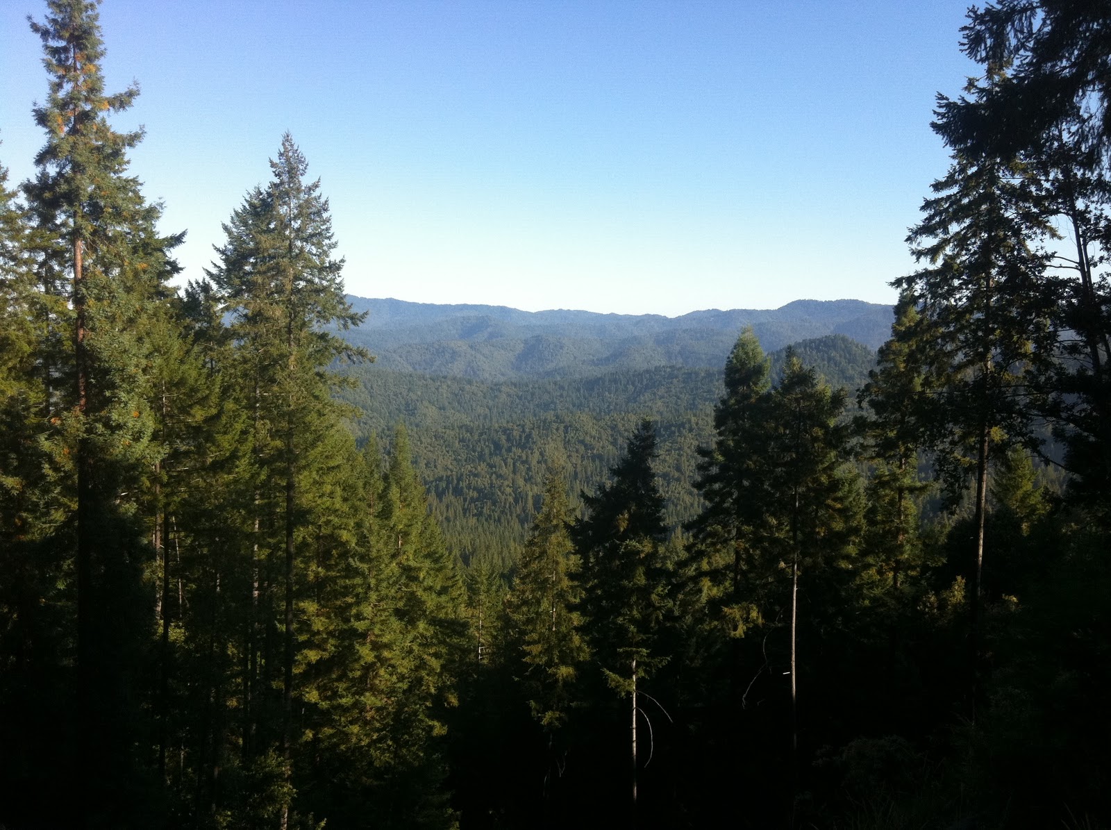
 |
| The view was simply epic |
On the plus side, the 49 is full of spectacularly breathtaking views – one after another – their beauty only tarnished by the low water level and dry foliage that is emblematic of California in August. The thought “Well that’s it, we’ve reached Peak View, it’s all downhill from here” cross my mind more than once, though obviously there are far more breathtaking views out there in bigger mountain ranges. One day, I’ll return here sometime around May, I’m sure it’ll be even more breathtaking in full bloom. Preferably, on a bike better designed to handle turns than the KLR. The road is not only twisty, but there are no guardrails to be found, and with traffic nearly non-existent, it’d be a good while before anyone came along to find your crashed self should you fail at keeping it rubber-side down. I adjusted speeds downward accordingly, just to be safe.
 In Oakhurst, the 41 dead ends into the 49 and it was here that I made the decision to tough it out to Fresno, partly in order to get up early and miss most of the heat on the way back to the coast. Initially, I headed for a Holiday Inn Express, but they wanted something like $110. Then, my brained turned on and I used the power of the internet to find a local Motel 6. $45 secured me crappy room in a sketchy-looking part of town, but hey, you get what you pay for and who is going to steal a KLR anyway. Besides, all I really wanted at that point was somewhere to lie down for a few hours. I finished the day with yet another trip to Carl’s Jr. (the first was for lunch in Yuba City due to a lack of anything better) and a couple warm PBRs. Ain’t life grand.
 |
| Ah, construction |
 |
| I chose to take the bridge rather than attempt to ford the river or hire a guide |
 |
| Peak View. At least for the ride. |
 |
| Another river crossing. |
 |
| Sunset on the way into Fresno |
 |
| This was a huge dick move |
 |
| How...odd |
No comments:
Post a Comment